
Nanga Parbat Rupal Face Base Camp
A supported 13-day Himalayan trek through Astore and Tarishing to the meadows and glaciated amphitheatre beneath Nanga Parbat’s immense Rupal Face.
Scheduled windows and private dates
| Dates | Reference | Status |
|---|---|---|
| 10–22 July 2027 | EP-011 | Registering interest |
| 07–19 August 2027 | EP-011 | Registering interest |
| 04–16 September 2027 | EP-011 | Registering interest |
Final pricing depends on group size, porter allocation, accommodation, road conditions and journey dates.
Request dates & priceThe Himalayan giant from its southern face
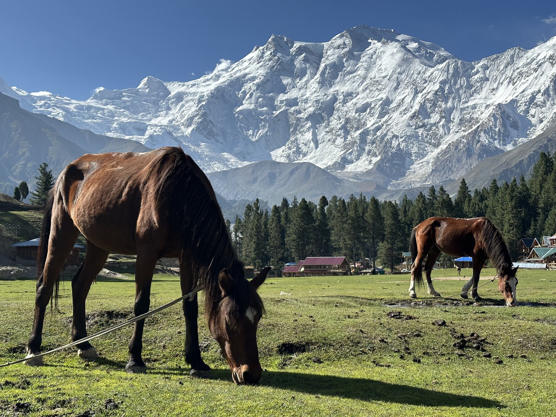
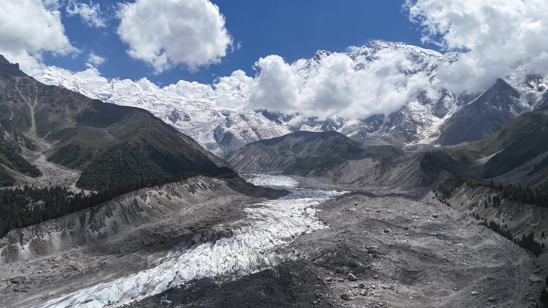
Nanga Parbat rises to 8,126 metres and is the world’s ninth-highest mountain. The Rupal Face drops roughly 4,600 metres from summit to valley, making it one of the greatest mountain walls on Earth. This route approaches through the Astore Valley and the village of Tarishing, combining acclimatisation, supported trekking and time beneath the glaciers of the southern massif.
The mountain was first climbed on 3 July 1953 by Austrian climber Hermann Buhl via the Rakhiot side. The Rupal Face entered mountaineering history in 1970 when Reinhold and Günther Messner made its first ascent; Günther died during the descent.
Nanga Parbat’s glaciers and alpine foreground
Why this Himalayan approach is exceptional
Thirteen days from Islamabad to the Rupal Valley
Arrival in Islamabad
Airport reception and private transfer to the hotel. A short evening briefing covers road conditions, equipment, weather and the trekking plan.
Islamabad to Chilas
Drive north along the Hazara Motorway and Karakoram Highway. The route may operate through Naran and Babusar Pass when seasonally open, or through Besham when conditions require.
Chilas to Astore and Tarishing
Follow the Indus before turning into the Astore Valley. Continue by mountain road to Tarishing, the principal gateway to the Rupal side of Nanga Parbat.
Tarishing acclimatisation and Rupal village
A measured acclimatisation day through cultivated terraces and village paths. Local walking provides context on farming, livestock and seasonal life below the mountain.
Tarishing to Herrligkoffer Base Camp
Trek through moraine, pasture and open valley terrain toward the established base-camp area named for German expedition leader Karl Herrligkoffer. Camp beneath the southern Nanga Parbat massif.
Base Camp acclimatisation and glacier viewpoints
A flexible exploration day for safe acclimatisation, photography and closer views of the Rupal Face, hanging glaciers and the valley’s immense vertical scale.
Day hike toward Latobah
Continue through alpine meadow toward Latobah for a broader perspective of the face and surrounding ridges. Return to camp; the exact turnaround point depends on weather and trail conditions.
Reserve day beneath Nanga Parbat
A planned reserve day protects the journey from mountain weather and allows an additional photographic or exploratory walk when conditions are favourable.
Return trek to Tarishing
Retrace the valley route to Tarishing, leaving the high camp for village accommodation and a well-earned rest.
Tarishing to Rama and Astore
Drive through Astore with time for Rama’s forest and meadow landscapes when road access permits. Overnight in the Astore area.
Astore to Gilgit
Return to the Indus corridor and continue to Gilgit. The afternoon is kept light for recovery and preparation for the onward journey.
Gilgit to Islamabad
Take the scheduled flight to Islamabad when operating. If cancelled, travel by road with the program adjusted for safety and realistic driving hours.
Islamabad departure
Private transfer to Islamabad International Airport. An additional post-journey buffer night is recommended before a separately booked international flight.
Day-by-day journey map
The map illustrates the journey sequence and approximate route. It is not intended for independent navigation; mountain trails and camps may change with weather, glaciers and local advice.
What is included and excluded
Included
- Private ground transportation with fuel
- Airport transfers in Pakistan
- Accommodation on twin-sharing basis
- Licensed local guide and trekking support team
- Porter support according to the final group plan
- Camping equipment and camp logistics
- Entrance fees, tolls and local coordination
- Visa-supporting documentation
Not included
- All meals and beverages
- International and domestic flights; booking assistance is available
- Pakistan visa fee
- Personal trekking equipment and sleeping bag
- Insurance covering trekking and emergency evacuation
- Tips, laundry, telephone use and personal expenses
- Costs caused by flight cancellation, weather or road closure
Best time and how to get there
Best time: July to September normally offers the most reliable access to Tarishing and the high Rupal Valley. Snow, rainfall and river conditions can still alter the route.
Access: The journey begins in Islamabad and reaches Astore by road through the Indus corridor. Tarishing is approached by local mountain road; the final section to base camp is completed on foot.
Preparation: Regular hill walking, broken-in trekking footwear and insurance covering trekking up to at least 4,000 metres are required.
Compare other Himalayan and Karakoram routes
Fairy Meadows, Nanga Parbat & Deosai · Rakaposhi Base Camp · Rush Lake Trek
Plan a realistic Rupal Face journey.
Share your preferred dates, group size, trekking experience and accommodation expectations. We will prepare the operational plan and final quotation.
Send an enquiry